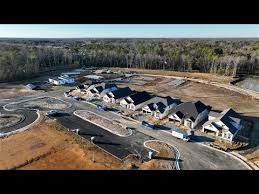
Aerial Surveying Drones In Richmond VA | I Fly Drones
- Street: 9507 Lyndonway
- City: Dr, Richmond
- State: VA
- Country: United States
- Zip/Postal Code: 23229
- Contact No: 804-356-5179
- Email ID: [email protected]
- Website: https://iflydrones.com/construction
- Listed: May 12, 2025 10:23 am
- Expires: 29 days, 23 hours
Description
I Fly Drones uses high-end aerial surveying drones in Richmond, VA for mapping, planning, and site assessments. Our technology captures detailed overhead data quickly, reducing the need for manual fieldwork. It’s an ideal solution for land developers, architects, and construction crews needing accurate, up-to-date information to support smarter planning and faster project execution.
1 total views, 1 today
Listing ID: 1596821cc294aacf